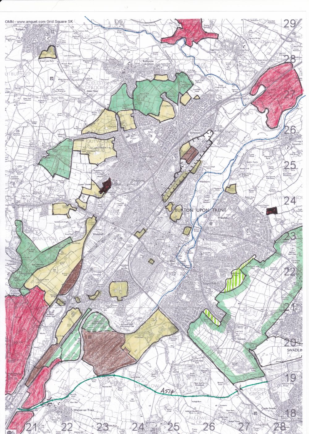
Slowly, slowly and then fastly fastly the countryside surrounding our towns is being eaten up by ‘the concrete monster of progress’. Here’s a local example; based on Ordnance Survey 1:25,000 mapping and a variety of sources, I give you a sketch map showing recent and future ‘development’ in the Burton area.
Key:-
Yellow – mostly housing (about 12,200 units)
Black – failed housing applications
Solid green – the so-called Rolleston / Stretton ‘Green Gap’ (not Green Belt)
Green enclosed area – South Derbyshire Green Belt against the Staffordshire border
Vertical green stripes – Burton Green belt(!)
Oblique green stripes – amenities areas
Brown – mainly commercial
Enclosed area north of town centre – proposed Derby Road ‘gateway’ improvement scheme (housing, commercial and amenities)
Crimson – gravel quarrying
Green line – possible route of A514 connecting road (A38 to A50 nr Derby).
One thought on “The ungreening of England: Burton area.”