Slowly, slowly and then fastly fastly the countryside surrounding our towns is being eaten up by ‘the concrete monster of progress’. I am mapping the recent and future development around my town, based on Ordnance Survey 1:25,000 mapping, local planning documents, and a variety of sources.
It’s eight months since I began posting about the ‘ungreening of England’ (http://wordpress.watsonlv.net/index.php/2018/07/25/the-ungreening-of-england-burton-area/) adding more information to the map of the Burton-on-Trent area, thus making substantive revisions each time. This updated map includes a proposed development (aka land grab) to the west of the town called Postern Park which will include up to 750 houses, a secondary school, playing fields, ‘retail/community’ and formal open spaces.
“The site currently has agricultural use, principally pasture, but also an Adventure Farm, which has a hard surface car park, play area and animal enclosures, accessed north of Postern Farmhouse, off Postern Road. The existing Grade 2 Listed farmhouse is only visible from a narrow stretch of Postern Road to the south, and is wrapped by existing farm buildings.” In no way can this pleasant area of grassland along the Needwood Forest eastern boundary be considered a ‘brownfield’ site.
This land grab is in addition to 2,500 homes to be built at Branston Locks, as well as 300 homes to the south of Forest Road and up to 250 homes at Lower Outwoods Road.
The total number of new homes on the map is now approximately 10,600.
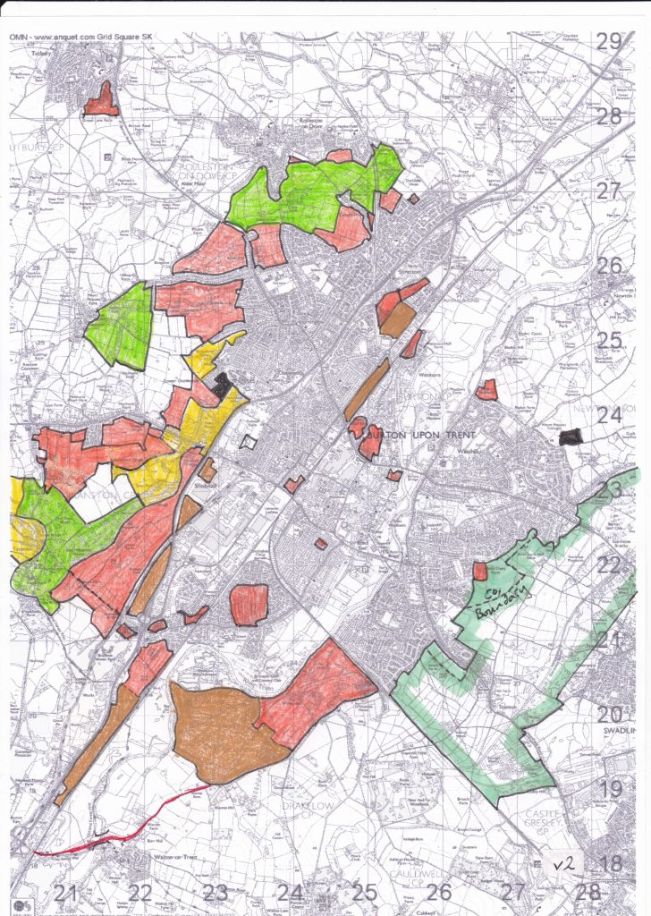
Key:
Red – mostly housing
Brown – mainly commercial
Black – failed housing application
Green enclosed area – Green Belt across the South Derbyshire / Staffordshire border
Solid green – the so-called Rolleston / Stretton ‘Green Gap’. Not Green Belt
Yellow – area of high quality landscape
Red line – Walton river crossing and road improvements. Construction due to start ‘soon’