The ungreening of England: Burton area.

Slowly, slowly and then fastly fastly the countryside surrounding our towns is being eaten up by ‘the concrete monster of progress’. Here’s a local example; based on Ordnance Survey 1:25,000 mapping and a variety of sources,  I give you a sketch map  showing  recent and future ‘development’ in the Burton area.

Key:-
Yellow – mostly housing (about 12,200 units)
Black – failed housing applications
Solid green – the so-called Rolleston / Stretton ‘Green Gap’ (not Green Belt)
Green enclosed area – South Derbyshire Green Belt against the Staffordshire border
Vertical green stripes – Burton Green belt(!)
Oblique green stripes – amenities areas
Brown – mainly commercial
Enclosed area north of town centre – proposed Derby Road ‘gateway’ improvement scheme (housing, commercial and amenities)
Crimson – gravel quarrying
Green line – possible route of A514 connecting road (A38 to A50 nr Derby).

Brexit and me (abridged).

I voted not to leave the EU at the recent referendum. That does not mean that I wish to stay in the EU either.

I was 20 years old when I voted to join the European Economic Community (as it was then) in June 1975. I imagined that, coming from a Labour party voting family, Britain was joining a confederacy or brotherhood of equals, despite The Labour Party having ‘no official position’ on Europe. That referendum, which was strongly felt be unconstitutional by some legal experts, favoured entry to the EEC by 67% of those who turned up at the polling stations (65%).

I joined the Labour Party in 1979. I realised, even at that tender age, the Tories – under Thatcher or not – were determined to undermine and ultimately destroy the social welfare system, including selling off the all the public utilities and lastly the NHS. I was an active member during the 1980s but my scepticism about the Party increased during the following decade. When Blair came to power it seemed the damage done by the Tories in the previous decade might be halted or reversed. Not to be. Blair – or the Blue Mole, as I came to see him – simply did the opposite. Third Way my arse. I left the Party after having been a member for 35 years.

Meanwhile, the EEC had morphed into a continental corporation, dominated by federation junkies, and becoming an ersatz United States of Europe. Britain sat in the corner only partially buying into ‘the dream’. If I had have wanted to be in a ‘united states’, I’d have emigrated to the U.S.A..

Then came along that toad Cameron – the Pontius Pilate of the 21st century. Just when we thought the EU squabbles couldn’t get worse, he made sure they did. He abandoned parliamentary democracy (such as it was), backed the weakened horse, lost his bet, and then simply WALKED AWAY.

When Britain voted by the slimmest of possible margin to leave the EU, this country, as far as I’m concerned, lost what little influence it had and has cast us all into a fire of anarchistic so-called free trade. Britain will walk away from the Frenchies and the Krauts, et all with nothing. No authority on the world diplomatic stage and no economic leverage, no ‘face’. Well done Britain.

Finally, I believe we should not have pursued a future within continental Europe, but certainly should not resorted to a plebiscite. I give Tony Benn the last words:

“If one meets a powerful person – Rupert Murdoch, perhaps, or Joe Stalin or Hitler – one can ask five questions: what power do you have; where did you get it; in whose interests do you exercise it; to whom are you accountable; and, how can we get rid of you? Anyone who cannot answer the last of those questions does not live in a democratic system.”

Speech in the House of Commons (16 November 1998)

Four legged pals.

Here’s Rufus and Connie, our two little ginger pets. Rufus (left) is a seven year old stray who came to live with us two years ago, and Connie is our five month old Cockerpoo.

As you can see they’re good pals. And a matching pair….

[Moreover] Rufus became poorly at the end of February 2018 and didn’t recover from an operation to deal with his blocked urethra. The nice lady vet put him out of his agony on the 2nd March. Connie misses him & tries to make friends with similar looking cats. No joy.

A little corner of history (4).

Are there Cutteslowe Walls today? Yes, you bet there are.

“The Cutteslowe Walls in Oxford, built in 1934, were over two metres high and topped with lethal spikes.  They divided the City Council’s Cutteslowe estate from private housing to the west which was developed by Clive Saxton of the Urban Housing Company.

“Saxton, described as every inch a businessman, was afraid that his housing would not sell if so-called ‘slum’ dwellers were going to be neighbours, and the walls were built to separate them. ”

http://www.bbc.co.uk/oxford/content/articles/2009/03/26/cutteslowe_feature.shtml

–o–

You might think all this nonsense was a thing of the past. But no, it is still part of modern housing development orthodoxy. There’s a good example just around the corner from me.

The map above shows three housing developments in the town. Their boundaries are shown in green. Top left is an avenue of council houses built in the 1930s (1), top right is a private estate built in the early 1990s (2), and at bottom the latest development built after 2009 on brownfield land (3). You can see they are examples of distinctly different types of urban planning.

A parish boundary enters at the bottom right  and exits at the top, with the town centre about a mile to the  south.

The houses in (1) are large semi-detached properties with long gardens running southwest to a ward boundary, those in (2) are medium size detached suburban properties, and those in (3) are modern two and three story urban properties. The green lines on the map are physical barriers, not breached by roads or footpaths.

The photograph above is looking north from location [X] towards (2).

This photograph is looking south from (2) towards [X].

OK, it’s not a wall like this

but a fence is as good as….

If you wanted to walk, cycle or drive from the fences south side to its north, you would face a 2½ mile detour.

To be fair, the estates are not separated by a wall which suggests it could be easily breached by a naughty schoolchild and, although sturdy, it does look a bit temporary. I imagine legal plans are in hand to remove the fence and create a safe cycle and foot path connecting the town to the urban – but ancient – village to the north.

I wonder how the “so-called ‘slum’ dwellers” will fare?

A little corner of history (3).

An Account of a Flying Accident at R.A.F. Tatenhill in November 1944.

A letter from Wal Denney – 8/1/1998.

Near the end of the war the trainees were kept at R.A.F. Tatenhill for an extended period because operational losses were, luckily, over estimated by the Air Ministry.

November 1944:  At night briefing, I informed the aircrews that it would be a clear cloudless night and fog was expected around midnight.  The Flight Commander had already informed them that there would only be one lot of cross county exercises but circuits and bumps would continue until the weather looked as if it was closing in.  Nearing midnight, as predicted, the visibility reduced to just less then 2,000 yards and it had been decided to cease flying after the six airborne trainees landed.  At that moment the control room lights went out.  Looking out to the airfield and all the lights were out.  Told the W/Ops to radio the pilots to circle until we could restore power – no radios – they worked off the power supply.  Grabbed the Tannoy mike – dead.  Telephone – dead.  By this time the W.A.A.F.s had connected the emergency batteries to the radios – guess what? – they had not been used for so many years, they were flat.  At that moment a telephone rang in the corner of the room that I had never used.  It was a field telephone connected to the beacon a few miles from the airfield and the electrician informed me the aircraft were circling his beacon.  Thank goodness I had at least a few minutes breathing space.  The normal emergency procedure would have been to divert to another airfield, but we were the highest field for miles around so all these would have been closed in, and how could I communicate with them or the aircraft anyway?  There was no way the trainee pilots could have been able to navigate for hundreds of miles without a pre-arranged route.  There was only the ground crew to do with the assistance of the fire crew.  It did not take them long and when they were clear of the runway, I had the pleasure of firing a white rocket for the first time in my life and the Airfield Controller signalled them in one by one using his Aldis Lamp.  I had told him on his field telephone the recognition letters.

All this time I watched the fog creeping up on us, but it was still reasonably safe, particularly as the paraffin flares gave a very good light.  All went well until the Airfield Controller informed me on the field telephone that the last aircraft was coming in to land before the penultimate aircraft had left the runway against his Red Aldis.  I went out to the balcony but, because of the fog and the smoke from the goose necks, I could not observe what was happening on the runway.  The penultimate aircraft might not have left the runway as he could have been confused because there were no perimeter lights.  I had no alternative but to fire a red Very.

The trainee went round again, but crashed a few hundred yards from the end of the runway[1].

Did he get caught in the notorious down draft at the end of Runway 22, but would there have been a down draft when there was no wind?  Can you “go through the gate” on an Oxford the same as on a Blenheim in an emergency? There was no enquiry so it has prayed on my mind ever since.  Was I responsible for this poor youngster’s death or would it have been possible that two aircraft would have crashed wasting two lives?  All this happened in far less time that it has taken to feed it into the W.P.  I always remember this incident with remorse when we experience a November fog, Remembrance Day or whenever an aircraft crash is reported (you can tell how clear it is in my mind 53 years later).

There was a sequel to this.  I had met the girl who was to be my wife in May  1944.  On this November night it took me all night and most of the morning writing reports and reporting verbally so had no sleep, but just had time for a bath before leaving camp to meet my fiancée in Derby where ‘Gone with the Wind’ was premiered.  I not only went to sleep in the bath, I slept through most of the film too.  Have seen this wretched film at least three times since and never have seen the middle of it.

[1] Possibly the accident of the 4 November involving the Oxford V3950 from 21 PAFU Wheaton Aston.

A little corner of history (2).

Some Thoughts About RAF Tatenhill by An Airman.

One’s memory 59 years after events occurred is not entirely reliable, but here are some recollections about flying at RAF Tatenhill in 1944. A royal Canadian Air Force officer, I received pilot training in Canada on North American Harvards, flew Miles Masters at 17 AFU at RAF Watton, and converted to Mustangs at 41 OTU at RAF Hawarden (and nearby Poulton). After tactical/fighter operations on Mustangs with 170 Squadron RAF, I was posted to the Flying Instructor Course on Airspeed Oxfords at RAF Montrose. My first posting as a qualified instructor was to 21 (P) AFU (Pilot Advanced Flying Unit) at RAF Tatenhill, near Burton-on-Trent, in early May 1944.

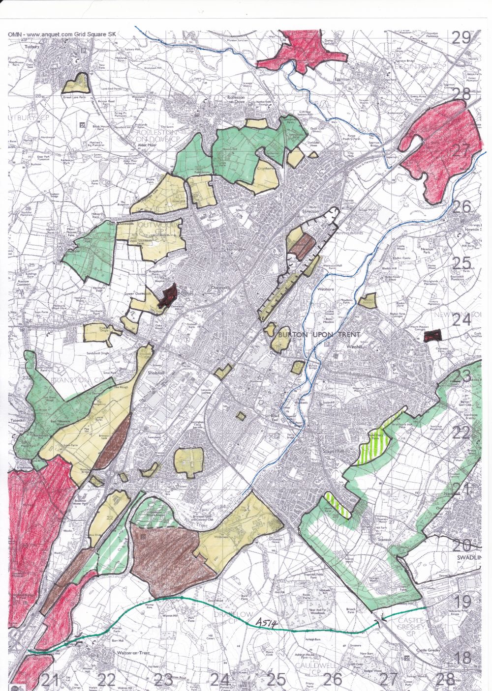
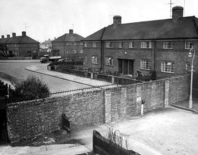
Having been stationed at a number of airfields in England, it’s difficult to remember the particulars of any one of them. Tatenhill, called Cross Plains by the locals, was in a lovely rural setting. The officer’s quarters, which were in a one-storey building, were reasonably comfortable with two officers to a room. The rooms contained small coal stoves. The toilets and bath houses were in adjacent buildings. Close by was the Officers’ Mess. It had a main lounge with fireplace and a billiard table, a bar, a separate dining room, and a cloak room near the entrance. Its main shell was still standing when I last visited the site, although one had to step around cow dung to view it. We ate all our meals in the Mess when on base. Occasionally we had parties and dances there, but more often we went into town for entertainment. Not far from the officer’s mess was the Sergeants Mess.

I can’t remember much about the hangar line, which was probably quite standard. I recall there being a bicycle shop in one of the lean-to’s, which was a busy place because almost everyone had a bicycle.

(The pubs in the area were well patronized. The closest was the New Inn on the nearby intersection where several roads (five I think) met. We also tippled at the Acorn at Rough Hayes, the nearby Burnt Gate and the Bell in Anslow. Sometimes we attended dances in Anslow’s village hall.)

The AFU students had already graduated as pilots. Some had earned their wings on single-engine Harvard or Master aircraft; others had trained on twins, such as Cessna Cranes, Avro Ansons, and Oxfords. We instructed them on the twin-engine Oxford to prepare them for further operational training on bomber aircraft.

For pilots trained under the British Commonwealth Air Training Plan (BCATP) in Canada and who had not yet experienced flying in the UK, AFU provided a useful orientation to flying over England’s terrain. Until one got used to it, navigating over this congested, confusing patchwork was a challenge. Nothing in the tangle of roads and railways ran in a straight line, and visibility was often reduced by industrial haze – so different from flying over Canada’s open spaces, where the roads, railways and farm fences ran straight and the skies were more often clear.

To digress for a moment, the BCATP under whose auspices most of us learned to fly was the greatest undertaking of its kind before or since. Altogether the plan produced 131,553 aircrew, of which 72,835 were RCAF. Other trainees were from the Royal Air Force (including Allied nationals, such as those from South Africa and Trinidad), Royal Australian Air Force and Royal New Zealand Air Force. Of the RCAF trainees, 25,747 were pilots, 12,855 navigators, 6,659 air bombers, 12,744 wireless air gunners, 12,917 air gunners and 1,913 flight engineers.

Fondly called the “Ox-box”, the Oxford had a reputation for being rather tricky to fly and it was said that having mastered it students would be well equipped to handle more powerful aircraft at Operational Training Units, which was the next step in their bomber training. The Oxford was powered by two 355h.p. Armstrong-Siddeley Cheetah radial engines. For most Canadian trained pilots, the Oxford’s instrumentation and controls took some getting used to. It had British turn and bank needles, instead of the American “needle and ball” display. Engine boost was calibrated in pounds rather than inches of mercury. Instead of hydraulic brakes operated by toe pressure on the rudder pedals, the Oxford had air brakes operated by a device on the control column.

A stout rope was fastened along the port side of the Oxford’s cabin, from the cockpit to the exit door. The Oxford’s spin was very flat and I heard that there had been incidents where people trying to abandon the aircraft had been thrown to the rear of the cabin by centrifugal force and trapped there, unable to reach the door. The rope gave one something to hang on to in these circumstances. My first flight at Tatenhill was on May 4th 1944. AFU instruction followed standard RAF sequences.

The hours available for night flying were greatly increased by means of what was called day/night training using sodium flares. This clever innovation made it possible to practise night flying circuits during daylight hours. High intensity sodium lamps along each side of the runway simulated a night flare path. Student pilots wore goggles fitted with dark lenses of different intensities, which could create the illusion of various night conditions from bright moonlight to complete darkness. The instructor, who didn’t wear the goggles, had a normal daylight view. It was a safe and effective way of doubling the night training capacity of the airfield.
The night flying curriculum included cross-country trips, my most vivid memory of which is the gorgeous colours of the sky and clouds. We’d take off just after dark. At cruising altitude the sun would just be setting, sometimes followed by the moon rising. Usually there was a blanket of stratus cloud to penetrate. Breaking out above it, we were often bathed in a spectacular panorama of colour, muted shades of red, orange, blue and mauve, an exquisite kaleidoscope of ever-changing pastels too beautiful to describe. On some of these night cross-country exercises we carried a wireless operator who maintained contact with base and provided bearings and homings to assist with navigation.

To help friendly forces navigate at night in the UK, the landscape was dotted with beacon lights that flashed Morse code identifiers that changed nightly. The beacons were of two types: Pundits and Occults. Pundits flashed red lights and identified geographical positions; Occults were white and were located near aerodromes.

Another useful aid was the DREM system (I can’t remember what the letters stood for), which helped night flying aircraft to land in bad weather. If you needed assistance you flew a certain pattern around the aerodrome’s Occult beacon and flashed an assigned code. Soon a large circle of yellow lights, about four miles in diameter, appeared on the ground, the lights about 200 yards apart. You flew around the circle until you saw a funnel of lights leading toward its centre. At the narrow end of the funnel was the runway. To minimize the chance of enemy aircraft seeing the DREM display, the lights behind you were extinguished as soon as you passed over them. Once in the funnel, you could see the lighted runway. A Glide Path Indicator was positioned on the left side of the runway button. It consisted of a vertical display of shielded coloured lights: amber if you were too high, green if you were on the correct glide path, and red if you were too low.

One day I was surprised at being assigned a student named Wing Commander James who’d already earned an Air Force Cross. It wasn’t just his senior rank that surprised me. I recognized him as the Squadron Leader who’d commanded my Flight when I was an ab-initio student pilot at SFTS in Canada. Now it was my turn to put him through the ropes!

Circling to land at Tatenhill on the afternoon of June 5th 1944, I witnessed a tragedy – an aircraft diving toward the ground in a tail spin. It was a Miles Martinet from Lichfield. It crashed and burned two miles northeast of Tatenhill, killing the two pilots, both Australians.

Personally, I’d lived a charmed life so far, having survived ops, as well as a head-on collision of two Mustangs at RAF Odiham. My luck still held when an incident occurred at Tatenhill that could have left me a cripple. During a training flight, a piece of metal broke off from the tip of a propeller blade. With a loud bang it shot through the nose section of the Oxford, passing about an inch above my ankle!

Hanbury Dump Explosion. At 1100 hrs on Nov 27th 1944 I was sitting on a toilet in the hangar area at Tatenhill when suddenly the ground shook and there was a horrendous roar. My first thought was that one of the new German V2 rockets must have landed nearby. It was far worse than that. In one brief moment near the village of Hanbury, five miles from our airfield, 1,500 two-ton “block-busters”, those huge town-smashing bombs that were dropped on Germany by our Lancaster bombers, that were stored in disused mine-workings, had detonated, together with hundreds of smaller bombs. It was the biggest single explosion of the war in the West. In this one fantastic bang, there had gone up nearly ten times the tonnage dropped on Coventry during its famous hours-long blitz. The explosion blasted a giant crater in the pastoral landscape a third of a mile long and a quarter of a mile wide. I flew over it next day to have a look. It wiped out of existence two complete farms and killed over 60 people and scores of farm animals. Buildings in Burton-on-Trent, five miles away were damaged. (Parts of this description are quoted from a newspaper source, which I’ve unfortunately mislaid.)

An important part of the AFU course was Beam Approach training. At the end of November I began instructing at 1515 BAT (Beam Approach Training) Flight at Poulton, near Chester, which was a unit of 21(P)AFU.

A little corner of history (1).


This curious photograph (click on all images to enlarge) appeared in the Burton Mail newspaper in the month Dad and I moved to the town: September 1966. It sets a group of local schoolchildren (and diary cows) against the background of the A38 bypass under construction.

Above is Branston in 1935 (Ordnance Survey). The A38 Exeter to Derby trunk road entered the village from the south west and left from the east.

Plans were made following the Second World War to improve the road, and for it to become a dual-carriageway between Streethay, north of Lichfield, and Littleover, south of Derby. This would include construction of a new road to bypass Burton. It would leave the A38 just south of Branston and skirt the town to the west.

The bypass under construction, 1967. The Gate Inn can be seen on the right, next to the original main road. The road included two narrow underpasses; one for pedestrian access along Tatenhill Lane, severed by the work, and another providing access to farmland from from Manor Farm – subject of the photograph at the top of the page.

This map from 1990 shows the grade separated junction (GSJ), as built but with the addition of the later Parkway, running to the north.

A large area of land was compulsorily purchased for construction of the road, including two farms and the original primary school. A new school was built within its property to the north. Before Parkway was built in 1989, there was a nasty 90° bend in the approach road, that saw a few lorries plunge into the grounds of the Rykneld primary school below.

Now to the point of all this.

A few years ago the, frankly, user unfriendly little roundabout at the junction of the link road (B1058) and Parkway was replaced by traffic lights. This included widening the section of road from the new traffic lights to the A38 interchange from 4 lanes to five. The farmer’s underpass was filled in and sealed off.

This situation is illustrated by the sketch map above. I’ve annotated the existing footpaths in blue and the pedestrian only extension from Parkway to the school gates as a green dashed line. Had the farm underpass not been backfilled, a new combined foot and cyclepath might have been constructed (at relatively little cost) from the south end of First Avenue to the new housing estate being built on the former fields of Manor Field. It would have provided a safe alternate route from Parkway to Branston village centre.

As Mr Trump might tweet “Poor planning, bad man!”

Footnote.

A large scale mixed-use development on a site to the west of the A38 is due to start construction soon, comprising up to 2,500 dwellings, up to 92,900 sq m of employment floor space, a local centre providing up to 3,716 sq m of retail floor space, up to 929 sq m of healthcare and associated community uses, a residential care home, up to 555 sq m of pub/restaurants, a primary school, and a hotel.

The foot and cycle path link from the south of the development will be from the canal near the Bridge Inn and through the existing A38 underpass to Main Street.